🎉 Up to 70% Off Selected ItemsShop Sale

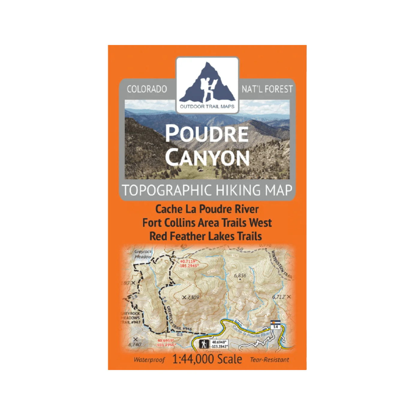
Outdoor Trail Maps Poudre Canyon Map
- Waterproof and tear-resistant – designed for on-trail use in harsh conditions
- 1:44,000 scale (1 in ≈ 0.7 mi)
- Smaller size (4”x7” folded, 27”x19” unfolded) and light weight – under 2 oz
- Trail segment mileages for all trails
- Lat-long coordinates for all trailheads and key trail junctions
- 50 ft contour lines
- Accurate, intuitive and easy-to-use
- UTM Grid
This map covers the hiking trails along the entire Poudre Canyon Highway from Fort Collins west to just before Cameron Pass, including the Red Feather Lakes area, Mount Margaret area, Cache La Poudre Wilderness and more.
$9.99
Outdoor Trail Maps Poudre Canyon Map—
$9.99
Product Information
Product Information
Shipping & Returns
Shipping & Returns
Description
- Waterproof and tear-resistant – designed for on-trail use in harsh conditions
- 1:44,000 scale (1 in ≈ 0.7 mi)
- Smaller size (4”x7” folded, 27”x19” unfolded) and light weight – under 2 oz
- Trail segment mileages for all trails
- Lat-long coordinates for all trailheads and key trail junctions
- 50 ft contour lines
- Accurate, intuitive and easy-to-use
- UTM Grid
This map covers the hiking trails along the entire Poudre Canyon Highway from Fort Collins west to just before Cameron Pass, including the Red Feather Lakes area, Mount Margaret area, Cache La Poudre Wilderness and more.